Time to correct the map!
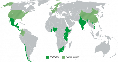
EfD uses a world map in our visual communication as a complement to our logotype. For over 450 years, most of the world has used a map that shows significant distortions in the sizes and relationships between continents.
The so-called Mercator map from the 16th century makes Africa look much too small, whereas the regions closer to the poles look too large. The Mercator map isn’t just about misrepresenting the size of the Global South — it’s also about power and significance. The Correct the Map Campaign urges the world to correct the map by adopting the Equal Earth projection, which more accurately reflects Africa's true size. EfD decided in 2025 to consequently use the Equal Earth Map.
About EfD
Environment for Development (EfD) is a global network of research centers specializing in...
EfD in 2025
Looking back, we are proud of what we have achieved. Despite dire developments for global...